Jersey (GPS: 49 15 N, 2 10 W) is located in Western Europe, an island in the English Channel, northwest of France. The country’s area measurements are total: 116 sq km; land: 116 sq km, water: 0 sq km. This sovereign state is about two-thirds the size of Washington, DC. The total irrigated land is N/A.
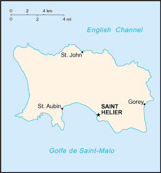
One of the essential features of Jersey: Largest and southernmost of Channel Islands. About 30% of the population concentrated in Saint Helier.
It’s significant, and at the same time, the principal city, Saint Helier’s GPS coordinates are 49 11 N 2 06 W. Saint Helier’s local time is 5 hours ahead of Washington DC during Standard Time. The capital’s time difference: UTC 0, note; Daylight saving time: +1hr begins last Sunday in March; ends last Sunday in October.
For more information on Jersey, please scroll down below the Google Maps.
Google Maps Jersey and Saint Helier, Europe
About Jersey in detail
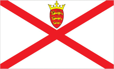
Flag of Jersey
Map of Jersey
Jersey and the other Channel Islands represent the last remnants of the medieval Duchy of Normandy that held sway in both France and England. These islands were the only British soil occupied by German troops in World War II. The Bailiwick of Jersey is a British crown dependency, which means that it is not part of the UK but is rather a self-governing possession of the British crown. However, the UK Government is constitutionally responsible for its defense and international representation.
Jersey’s names conventional long form: Bailiwick of Jersey, conventional short form: Jersey, etymology: the name is of Old Norse origin, but the meaning of the root “Jer(s)” is uncertain; the “-ey” ending means “island.” The name is of Old Norse origin, but the meaning of the root “Jer(s)” is uncertain; The “-ey” ending means “island.”
Jersey’s terrain is typically gently rolling plain with low, rugged hills along the north coast. The country’s mean elevation: N/A, elevation extremes; lowest point: Atlantic Ocean 0 m, highest point: unnamed, elevation 143 m.
The general climate in the country; temperate: mild winters and cool summers.
The total number of border countries is 0; none are the neighboring nations with the indicated border lengths. Jersey’s coastline is 70 km, while its marital claims are: territorial sea: 3 nautical miles, exclusive fishing zone: 12 nautical miles. Waterways: N/A. Land use: agricultural land: 66%; arable land 66%; permanent crops 0%; permanent pasture 0%; forest: 0%; other: 34% (2011 estimate).
The population in Jersey 99,602 (July 2018 estimate), urban population: 31.4% of total population (2014), major urban area’s population: N/A, while Jersey has a fairly even distribution; no notable trends. Their spoken languages are: English 94.5% (official language), Portuguese 4.6%, other 0.9% (2001 census). The main religions in Jersey are Protestant (Anglican, Baptist, Congregational New Church, Methodist, Presbyterian), Roman Catholic. The nation uses the laws of the UK, where applicable, apply; local statutes. It is a(n) parliamentary democracy (Assembly of the States of Jersey); a Crown dependency of the UK, National holiday(s) Liberation Day, 9 May (1945).
Economic overview for the country: Jersey’s economy is based on international financial services, agriculture, and tourism. In 2016, the financial services sector accounted for about 41% of the island’s output. Agriculture represented about 1% of Jersey’s economy in 2016. Potatoes are an important export crop, shipped mostly to the UK. The Jersey breed of dairy cattle originated on the island and is known worldwide. The dairy industry remains vital to the island, with approximately $8.8 million gallons of milk produced in 2015. Tourism accounts for a significant portion of Jersey’s economy, with more than 700,000 total visitors in 2015. Living standards come close to those of the UK. All raw material and energy requirements are imported, and a large share of Jersey’s food needs. Light taxes and death duties make the island a famous offshore financial center. Jersey maintains its relationship with the EU through the UK. Therefore, in light of the UK’s decision to leave the EU, Jersey will also need to renegotiate its ties to the EU.
Natural resources of Jersey: arable land.
Main export partners for Jersey, Europe are N/A for light industrial and electrical goods, dairy cattle, foodstuffs, textiles, and flowers. The country’s main import partners are N/A for machinery and transport equipment, manufactured goods, foodstuffs, mineral fuels, chemicals.
When you visit this country in Europe, consider the natural hazards in Jersey: N/A, while infectious diseases are N/A. Also, note that Jersey faces the following environmental issues: Habitat and species depletion due to human encroachment, water pollution, Improper solid waste disposal.
You may also be interested in the countries next to Jersey around its 0 km border – No border countries.