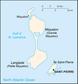
Saint Pierre and Miquelon (GPS: 46 50 N, 56 20 W) located in Northern North America, islands in the North Atlantic Ocean, south of Newfoundland (Canada). The country’s area measurements are total: 242 sq km; land: 242 sq km, water: 0 sq km. This sovereign state is one and half times the size of Washington, DC. The total irrigated land is 0 sq km (2012).
One of the crucial features of Saint Pierre and Miquelon: Vegetation scanty. The islands are part of the northern Appalachians, along with Newfoundland.
It’s significant, and at the same time, the principal city, Saint-Pierre’s GPS coordinates, 46 46 N 56 11 W. Saint-Pierre’s local time is 2 hours ahead of Washington DC during Standard Time. The capital’s time difference: UTC-3, note; Daylight saving time: +1hr begins second Sunday in March; ends first Sunday in November.
Google Maps Saint Pierre and Miquelon and Saint-Pierre, North America
About Saint Pierre and Miquelon in detail
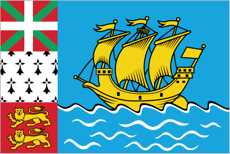
Flag of Saint Pierre and Miquelon
Map of Saint Pierre and Miquelon
First settled by the French in the early 17th century, the islands represent the sole remaining vestige of France’s once vast North American possessions. They attained the status of an overseas collectivity in 2003.
Saint Pierre and Miquelon’s names conventional long form: Territorial Collectivity of Saint Pierre and Miquelon, conventional short form: Saint Pierre and Miquelon, local long form: Departement de Saint-Pierre et Miquelon, local short form: Saint-Pierre et Miquelon, etymology: Saint-Pierre is named after Saint PETER, the patron saint of fishermen; Miquelon may be a corruption of the Basque name Mikelon.
Saint Pierre and Miquelon’s terrain is typically mostly barren rock. The country’s mean elevation: N/A, elevation extremes; lowest point: the Atlantic Ocean 0 m, highest point: Morne de la Grande Montagne 240 m.
The country’s general climate is cold and wet, with many mist and fog: spring and autumn are often windy.
The total number of border countries is 0; none are the neighboring nations with the indicated border lengths. Saint Pierre and Miquelon’s coastline is 120 km, while its marital claims are: territorial sea: 12 nautical miles, exclusive economic zone: 200 nautical miles. Waterways: N/A. Land use: agricultural land: 8.7%; arable land 8.7%; permanent crops 0%; permanent pasture 0%; forest: 12.5%; other: 78.8% (2011 estimate).
The population in Saint Pierre and Miquelon 5,471 (July 2018 estimate), urban population: 90.4% of total population (2015), central urban area’s population: SAINT-PIERRE (capital) 5,000 (2014), while Saint Pierre and Miquelon have most of the population is found on Saint Pierre Island; a small settlement is located on the north end of Miquelon Island. Their spoken languages are French (official language). The main religions in Saint Pierre and Miquelon are Roman Catholic 99%, other 1%. The nation uses French civil law. It is a(n) parliamentary democracy (Territorial Council); an overseas collectivity of France, National holiday(s) Fete de la Federation, 14 July (1789).
Economic overview for the country: The inhabitants have traditionally earned their livelihood by fishing and servicing fishing fleets operating off Newfoundland’s coast. However, the economy has been declining because of disputes with Canada over fishing quotas and a steady decline in the number of ships stopping at Saint Pierre. The services sector accounted for 86% of GDP in 2010; the last year data is available.
Government employment accounts for 46% of the GDP, and 78% of the population is working age. The government hopes an expansion of tourism will boost economic prospects. Fish farming, crab fishing, and agriculture are being developed to diversify the local economy. Recent test drilling for oil may pave the way for the development of the energy sector. Trade is the second largest sector in terms of value-added created, contributing significantly to economic activity. The extractive industries and energy sector is the third-largest sector of activity in the archipelago, attributable to the construction of a new thermal power plant in 2015.
Natural resources of Saint Pierre and Miquelon: fish, deepwater ports.
Main export partners for Saint Pierre and Miquelon, North America are N/A for fish and fish products, soybeans, animal feed, mollusks and crustaceans, fox and mink pelts, while the main import partners for the country are: N/A for meat, clothing, fuel, electrical equipment, machinery, building materials.
When you visit this country in North America, consider the natural hazards in Saint Pierre and Miquelon: Persistent fog throughout the year can be a maritime hazard, while infectious diseases are N/A. Also, note that Saint Pierre and Miquelon faces the following environmental issues: Overfishing, Recent test drilling for oil in waters around Saint Pierre and Miquelon may bring future development that would impact the environment.
You may also be interested in the countries next to Saint Pierre and Miquelon around its 0 km border – No border countries.