Syria (GPS: 35 00 N, 38 00 E) located in Middle East, bordering the Mediterranean Sea, between Lebanon and Turkey. The country’s area measurements are total: 185,180 sq km; land: 183,630 sq km, water: 1,550 sq km. This sovereign state is slightly more than 1.5 times the size of Pennsylvania. The total irrigated land is 14,280 sq km (2012).
One of the essential features of Syria: Damascus’s capital – located at an oasis fed by the Barada River – is thought to be one of the world’s oldest continuously inhabited cities. There are 42 Israeli settlements and civilian land use sites in the Israeli-controlled Golan Heights (2017).
It’s significant, and at the same time, the principal city, Damascus’s GPS coordinates are 33 30 N 36 18 E. Damascus’s local time is 7 hours ahead of Washington DC during Standard Time. The capital’s time difference: UTC+2, note; Daylight saving time: +1hr begins midnight on the last Friday in March; ends at midnight on the first Friday in November.
For more information on Syria, please scroll down below the Google Maps.
Google Maps Syria and Damascus, Middle East
About Syria in detail
Flag of Syria
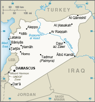
Map of Syria
Following World War I, France acquired a mandate over the northern portion of the former Ottoman Empire province of Syria. The French administered the area as Syria until granting it independence in 1946. The new country lacked political stability and experienced a series of military coups. Syria united with Egypt in February 1958 to form the United Arab Republic. In September 1961, the two entities separated, and the Syrian Arab Republic was reestablished. In the 1967 Arab-Israeli War, Syria lost the Golan Heights region to Israel. During the 1990s, Syria and Israel held occasional, albeit unsuccessful, peace talks over its return.
In November 1970, Hafiz al-ASAD, a member of the socialist Ba’ath Party and the minority Alawi sect, seized power in a bloodless coup and brought political stability to the country. Following the death of President Hafiz al-ASAD, his son, Bashar al-ASAD, was approved as president by popular referendum in July 2000. Syrian troops – stationed in Lebanon since 1976 in an ostensible peacekeeping role – were withdrawn in April 2005. During the July-August 2006 conflict between Israel and Hizballah, Syria placed its military forces on alert but did not intervene directly on behalf of its ally Hizballah.
In May 2007, Bashar al-ASAD’s second term as president was approved by popular referendum. Influenced by major uprisings that began elsewhere in the region, and compounded by additional social and economic factors, anti-government protests broke out first in the southern province of Dar’ an in March 2011 with protesters calling for the repeal of the restrictive Emergency Law allowing arrests without charge, the legalization of political parties, and the removal of corrupt local officials. Demonstrations and violent unrest spread across Syria, with the size and intensity of protests fluctuating. The government responded to the stir with a mix of concessions – including the repeal of the Emergency Law, new laws permitting new political parties, and liberalizing local and national elections – and military force and detentions. The government’s efforts to quell unrest and armed opposition activity led to extended clashes and, eventually, civil war between government forces, allies, and oppositionists. International pressure on the ASAD regime intensified after late 2011, as the Arab League, the EU, Turkey, and the US expanded economic sanctions against the government and those entities that support it. In December 2012, the Syrian National Coalition was recognized by more than 130 countries as the sole legitimate representative of the Syrian people. In September 2015, Russia launched a military intervention on behalf of the ASAD regime. Domestic and foreign government-aligned forces recaptured swaths of territory from opposition forces, and eventually, the country’s second-largest city, Aleppo, in December 2016, shifting the conflict in the regime’s favor.
With this foreign support, the regime also recaptured opposition strongholds in the Damascus suburbs and the southern province of Dar’ an in 2018. The government lacks territorial control over much of the country’s northeastern part, which is dominated by the predominantly Kurdish Syrian Democratic Forces (SDF). The SDF has expanded its territorial hold over much of the northeast since 2014 as it has captured territory from the Islamic State of Iraq and Syria.
Since 2016, Turkey has also conducted three large-scale military operations into Syria, capturing region along Syria’s northern border in the provinces of Aleppo, Ar Raqqah, and Al Hasakah. Political negotiations between the government and opposition delegations at UN-sponsored Geneva conferences since 2014 have failed to produce a resolution of the conflict. Since early 2017, Iran, Russia, and Turkey have held separate political negotiations outside of UN auspices to reduce violence in Syria. According to an April 2016 UN estimate, the death toll among Syrian Government forces, opposition forces, and civilians was over 400,000, though other estimates placed the number well over 500,000. As of December 2019, approximately 6 million Syrians were internally displaced. About 11.1 million people needed humanitarian assistance across the country, and an additional 5.7 million Syrians were registered refugees in Turkey, Jordan, Iraq, Egypt, and North Africa. The conflict in Syria remains one of the largest humanitarian crises worldwide.
Syria’s names conventional long form: the Syrian Arab Republic, traditional short way: Syria, local extended state: Al Jumhuriyah al Arabiyah as Suriyah, local transient state: Suriyah, former: United Arab Republic (with Egypt), etymology: name ultimately derived from the ancient Assyrians who dominated northern Mesopotamia, but whose reach also extended westward to the Levant; over time, the name came to be associated more with the western area. The term ultimately derived from the ancient Assyrians who dominated northern Mesopotamia, but whose reach also extended westward to the Levant; Over time, the name became associated more with the western area.
Syria’s terrain is typically primarily semiarid and desert plateau; narrow coastal plain; mountains in the west. The country’s mean elevation: 514 m, elevation extremes; lowest point: unnamed location near Lake Tiberias -200 m, highest point: Mount Hermon 2,814 m.
The general climate in the country; mostly desert: hot, dry, sunny summers (June to August) and mild, rainy winters (December to February) along the coast: cold weather with snow or sleet periodically in Damascus.
The total number of border countries is 5, Iraq 599 km, Israel 83 km, Jordan 379 km, Lebanon 403 km; Turkey 899 km are the neighboring nations with the indicated border lengths. Syria’s coastline is 193 km, while its marital claims are: territorial sea: 12 nautical miles, contiguous zone: 24 nautical miles. Waterways: 900 km (navigable but not economically significant) (2011). Land use: agricultural land: 75.8%; arable land 25.4%; permanent crops 5.8%; permanent pasture 44.6%; forest: 2.7%; other: 21.5% (2011 estimate).
The population in Syria 19,454,263 (July 2018 estimate), urban population: 57.7% of total population (2015), central metropolitan area’s population: Aleppo 3.562 million; DAMASCUS (capital) 2.566 million; Hims (Homs) 1.641 million; Hamah 1.237 million; Lattakia 781,000 (2015), while Syria has significant population density along the Mediterranean coast; larger concentrations found in the major cities of Damascus, Aleppo (the country’s largest city), and Hims (Homs); more than half of the population lives in the coastal plain, the province of Aleppo, and the Euphrates River valley. Their spoken languages are Arabic (official language), Kurdish, Armenian, Aramaic, Circassian, French, English. Main religions in Syria are Muslim 87% (official; includes Sunni 74% and Alawi, Ismaili, and Shia 13%), Christian 10% (includes Orthodox, Uniate, and Nestorian), Druze 3%, Jewish (few remaining in Damascus and Aleppo). The nation uses a mixed legal system of civil and Islamic law (for family courts). It is a(n) presidential republic, a highly authoritarian regime, National holiday(s) Independence Day, 17 April (1946).
Economic overview for the country: Syria’s economy has deeply deteriorated amid the ongoing conflict in 2011, declining by more than 70% from 2010 to 2017. The government has struggled to address the effects of international sanctions fully, widespread infrastructure damage, diminished domestic consumption and production, reduced subsidies, and high inflation, which have caused dwindling foreign exchange reserves, rising budget and trade deficits, a decreasing value of the Syrian pound, and falling household purchasing power. In 2017, some economic indicators began to stabilize, including the exchange rate and inflation, but economic activity remains depressed, and GDP almost certainly fell.
During 2017, the ongoing conflict and continued unrest and economic decline worsened the humanitarian crisis, necessitating high international assistance levels, as more than 13 million people remain in need inside Syria, and the number of registered Syrian refugees increased from 4.8 in 2016 to more than 5.4 million. Before the turmoil, Damascus had begun liberalizing economic policies, including cutting lending interest rates, opening private banks, consolidating multiple exchange rates, raising prices on some subsidized items, and establishing the Damascus Stock Exchange, but the economy remains highly regulated. Long-run economic constraints include foreign trade barriers, declining oil production, high unemployment, rising budget deficits, increasing pressure on water supplies caused by heavy use in agriculture, industrial contraction, water pollution, and widespread infrastructure damage.
Natural resources of Syria: petroleum, phosphates, chrome and manganese ores, asphalt, iron ore, rock salt, marble, gypsum, hydropower.
Main export partners for Syria, Middle East are Iraq 64.7%, Saudi Arabia 11.2%, Kuwait 7.1%, UAE 6.1%, Libya 4.6% (2015) for crude oil, minerals, petroleum products, fruits and vegetables, cotton fiber, textiles, clothing, meat and live animals, wheat, while the main import partners for the country are: Saudi Arabia 28%, UAE 13.7%, Iran 10.1%, Turkey 9%, Iraq 8.3%, China 6.1% (2015) for machinery and transport equipment, electric power machinery, food and livestock, metal and metal products, chemicals and chemical products, plastics, yarn, paper.
When you visit this country in the Middle East, consider the natural hazards in Syria: Dust storms, sandstorms, volcanism: Syria’s two historically active volcanoes, Es Safa, and an unnamed volcano near the Turkish border have not erupted in centuries, while infectious diseases are N/A. Also, note that Syria faces the following environmental issues: Deforestation, Overgrazing, Soil erosion, Desertification, Depletion of water resources, water pollution from raw sewage and petroleum refining wastes, Inadequate potable water.
You may also be interested in the countries next to Syria around its total: 2,363 km border, like Iraq, Israel, Jordan, Lebanon, Turkey.