Tokelau (GPS: 9 00 S, 172 00 W) is located in Oceania, a group of three atolls in the South Pacific Ocean, about one-half of the way from Hawaii to New Zealand. The country’s area measurements are total: 12 sq km; land: 12 sq km, water: 0 sq km. This sovereign state is about 17 times the size of the National Mall in Washington, DC. The total irrigated land is 0 sq km (2012).
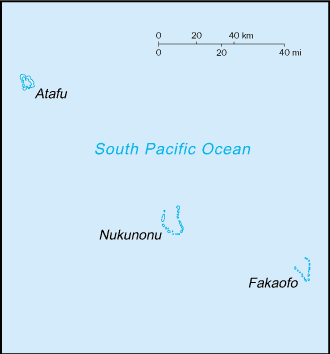
One of the important features of Tokelau: Consists of three atolls (Atafu, Fakaofo, Nukunonu), each with a lagoon surrounded by several reef-bound islets of varying length and rising to over 3 m above sea-level.
It’s significant, and at the same time, the principal city, no official capital’s GPS coordinates are N/A. No official capital’s local time is 18 hours ahead of Washington DC during Standard Time. The capital’s time difference: UTC+13.
For more information on Tokelau, please scroll down below the Google Maps.
Google Maps Tokelau and no official capital, Oceania
About Tokelau in detail
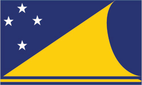
Flag of Tokelau
Map of Tokelau
Originally settled by Polynesian emigrants from surrounding island groups, the Tokelau Islands were made a British protectorate in 1889. They were transferred to the New Zealand administration in 1925. Referenda held in 2006 and 2007 to change the islands’ status from that of a New Zealand territory to one of free association with New Zealand did not meet the needed threshold for approval.
Tokelau’s names conventional long form: none, conventional short form: Tokelau, etymology: “tokelau” is a Polynesian word meaning “north wind.” “Tokelau” is a Polynesian word meaning “north wind.”
Tokelau’s terrain is typically low-lying coral atolls enclosing large lagoons. The country’s mean elevation: N/A, elevation extremes; lowest point: Pacific Ocean 0 m, highest point: unnamed location 5 m.
The general climate in the country; tropical: moderated by trade winds (April to November).
The total number of border countries is 0; none are the neighboring nations with the indicated border lengths. Tokelau’s coastline is 101 km, while its marital claims are: territorial sea: 12 nautical miles, exclusive economic zone: 200 nautical miles. Waterways: N/A. Land use: agricultural land: 60%; arable land 0%; permanent crops 60%; permanent pasture 0%; forest: 0%; other: 40% (2011 estimate).
The population in Tokelau 1,285 (2016 estimate), urban population: 0% of total population (2015), major urban area’s population: N/A, while Tokelau has N/A. Their spoken languages are: Tokelauan 93.5% (a Polynesian language), English 58.9%, Samoan 45.5%, Tuvaluan 11.6%, Kiribati 2.7%, other 2.5%, none 4.1%, unspecified 0.6%. Note: shares sum to more than 100% because some respondents gave more than one answer on the census (2011 tests.).
Main religions in Tokelau are Congregational Christian Church 58.2%, Roman Catholic 36.6%, Presbyterian 1.8%, other Christian 2.8%, Spiritualism and New Age 0.1%, unspecified 0.5% (2011 estimate). The nation uses common law system of New Zealand. It is a(n) parliamentary democratic dependency (General Fono); a territory of New Zealand, National holiday(s) Waitangi Day (Treaty of Waitangi established British sovereignty over New Zealand), 6 February (1840).
Economic overview for the country: Tokelau’s small size (three villages), isolation, and lack of resources much restrain economic development and confine agriculture to the subsistence level. The principal sources of revenue are from sales of copra, postage stamps, souvenir coins, and handicrafts. Money is also remitted to families from relatives in New Zealand. The people rely heavily on aid from New Zealand – about $15 million annually in FY12/13 and FY13/14 – to maintain public services. New Zealand’s support amounts to 80% of Tokelau’s recurrent government budget. An international trust fund, currently worth nearly $32 million, was established in 2004 by New Zealand to provide Tokelau an independent source of revenue.
Natural resources of Tokelau: NEGL.
Main export partners for Tokelau, Oceania are N/A for stamps, copra, handicrafts, while the main import partners for the country are: N/A for foodstuffs, building materials, fuel.
When you visit this country in Oceania, consider the natural hazards in Tokelau: Lies in Pacific typhoon belt, while infectious diseases are N/A. Also, note that Tokelau faces the following environmental issues: Overexploitation of certain fish and other marine species, coastal sand, and forest resources, Pollution of freshwater lenses and coastal waters from improper disposal of chemicals.
You may also be interested in the countries next to Tokelau around its 0 km border – No border countries.