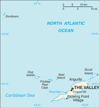
Anguilla (GPS: 18 15 N, 63 10 W) is located in the Caribbean, islands between the Caribbean Sea and North Atlantic Ocean, east of Puerto Rico. The country’s area measurements are total: 91 sq km; land: 91 sq km, water: 0 sq km. This sovereign state is about one-half the size of Washington, DC. The total irrigated land is 0 sq km (2012).
One of Anguilla’s essential features: The most northerly of the Leeward Islands in the Lesser Antilles.
It’s significant, and at the same time, the principal city, The Valley’s GPS coordinates are 18 13 N 63 03 W. The Valley’s local time is 1 hour ahead of Washington DC during Standard Time. The capital’s time difference: UTC-4.
Google Maps Anguilla and The Valley, Central America and the Caribbean
About Anguilla in detail
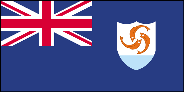
Flag of Anguilla
Map of Anguilla
Colonized by English settlers from Saint Kitts in 1650, Anguilla was administered by Great Britain until the early 19th century, when the island – against the wishes of the inhabitants – was incorporated into a single British dependency along with Saint Kitts and Nevis. Several attempts at separation failed. In 1971, two years after a revolt, Anguilla was finally allowed to secede; This arrangement was formally recognized in 1980, with Anguilla becoming a separate British dependency. On 7 September 2017, the island suffered extensive damage from Hurricane Irma, particularly communications and residential and business infrastructure.
Anguilla’s names conventional long form: none, traditional short form: Anguilla, etymology: the name Anguilla means “eel” in various Romance languages (Spanish, Italian, Portuguese, French) likely derives from the island’s long shape.
Anguilla’s terrain is a typically flat and low-lying island of coral and limestone. The country’s mean elevation: N/A, elevation extremes; lowest point: the Caribbean Sea 0 m, highest point: Crocus Hill 65 m.
The general climate in the country; tropical: moderated by northeast trade winds.
The total number of border countries is 0; none are the neighboring nations with the indicated border lengths. Anguilla’s coastline is 61 km, while its marital claims are: territorial sea: 3 nautical miles, exclusive fishing zone: 200 nautical miles. Waterways: N/A. Land use: agricultural land: 0%; arable land 0%; permanent crops 0%; permanent pasture 0%; forest: 61.1%; other: 38.9% (mostly rock with some commercial salt ponds) (2011 estimate).
The population in Anguilla 17,422 (July 2018 estimate), urban population: 100% of total population (2015), major urban area’s population: THE VALLEY (capital) 1,000 (2014), while Anguilla has most of the population is concentrated in The Valley in the center of the island; settlement is fairly uniform in the southwest, but rather sparse in the northeast. Their spoken languages are English (official language). Main religions in Anguilla are Protestant 73.2% (includes Anglican 22.7%, Methodist 19.4%, Pentecostal 10.5%, Seventh Day Adventist 8.3%, Baptist 7.1%, Church of God 4.9%, Presbyterian 0.2%, Brethren 0.1%), Roman Catholic 6.8%, Jehovah’s Witness 1.1%, other Christian 10.9%, other 3.2%, unspecified 0.3%, none 4.5% (2011 estimate). The nation uses common law based on the English model. It is a(n) parliamentary democracy (House of Assembly); self-governing overseas territory of the UK, National holiday(s) Anguilla Day, 30 May (1967).
Economic overview for the country: Anguilla has few natural resources, is unsuited for agriculture, and the economy depends heavily on luxury tourism, offshore banking, lobster fishing, and remittances from emigrants. Increased activity in the tourism industry has spurred the construction sector’s growth, contributing to economic growth. Anguillan officials have put substantial effort into developing the offshore financial sector, which is small but growing. In the medium term, prospects for the economy will depend mainly on the recovery of the tourism sector and, therefore, on revived income growth in the industrialized nations and favorable weather conditions.
Natural resources of Anguilla: salt, fish, lobster.
Main export partners for Anguilla, Central America, and the Caribbean are N/A for lobster, fish, livestock, salt, concrete blocks, rum, while the main import partners for the country are: N/A for fuels, foodstuffs, manufactures, chemicals, trucks, textiles.
When you visit this country in Central America and the Caribbean, consider the natural hazards in Anguilla: Frequent hurricanes and other tropical storms (July to October), while infectious diseases are noted: active local transmission of Zika virus by Aedes species mosquitoes have been identified in this country (as of August 2016); it poses a critical risk (a large number of cases possible) among US citizens if bitten by an infective mosquito; other less common ways to get Zika are through sex, via blood transfusion, or during pregnancy, in which the pregnant woman passes Zika virus to her fetus (2016). Also, note that Anguilla faces the following environmental issues: Supplies of potable water sometimes cannot meet increasing demand mainly because of the low distribution system.
You may also be interested in the countries next to Anguilla around its 0 km border – No border countries.