Mexico (GPS: 23 00 N, 102 00 W) located in North America, bordering the Caribbean Sea and the Gulf of Mexico, between Belize and the United States and bordering the North Pacific Ocean, between Guatemala and the United States. The country’s area measurements are total: 1,964,375 sq km; land: 1,943,945 sq km, water: 20,430 sq km. This sovereign state is slightly less than three times the size of Texas. The total irrigated land is 65,000 sq km (2012).
One of the essential features of Mexico: Strategic location on the southern border of the US. Mexico is one of the countries along the Ring of Fire, a belt of active volcanoes and earthquake epicenters bordering the Pacific Ocean. Up to 90% of the world’s earthquakes and some 75% of the world’s volcanoes occur within the Ring of Fire. The “Three Sisters” companion plants – winter squash, maize (corn), and climbing beans – served as the main crops for various North American Indian groups. All three originated in Mexico but then were widely disseminated through much of North America. Vanilla, the world’s most popular aroma, and flavor spice, also emanates from Mexico.
The Sac Actun cave system at 348 km (216 mi) is the longest underwater cave globally and the second-longest cave worldwide, after Mammoth Cave in the United States. Mexico, Guatemala, and Belize share the prominent Yucatan Peninsula that divides the Gulf of Mexico from the Caribbean Sea. On the northern coast of Yucatan, near the town of Chicxulub (pronounce cheek-sha-loob), lie the remnants of a massive crater (some 150 km in diameter and extending well out into the Gulf of Mexico). Formed by an asteroid or comet when it struck the earth 66 million years ago, the impact is now widely accepted as initiating a worldwide climate disruption that caused a mass extinction of 75% of all the earth’s plant and animal species – including the non-avian dinosaurs.
It’s significant, and at the same time, the principal city, Mexico City’s GPS coordinates are 19 26 N 99 08 W. Mexico City’s local time is 1 hour behind Washington DC during Standard Time. The capital’s time difference: UTC-6, note; Daylight saving time: +1hr begins first Sunday in April; ends last Sunday in October. Note: Mexico has four time zones.
For more information on Mexico, please scroll down below the Google Maps.
Google Maps Mexico and Mexico City, North America
About Mexico in detail
Flag of Mexico
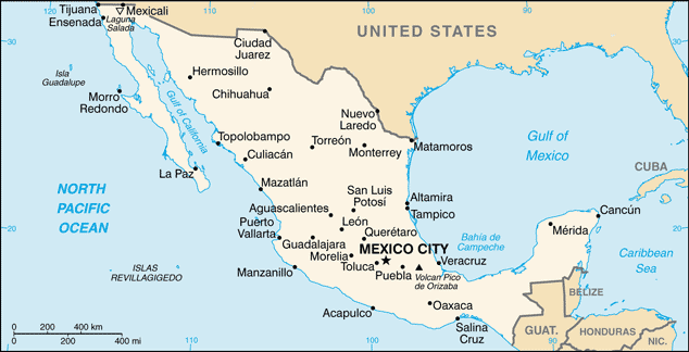
Map of Mexico
Several advanced Amerindian civilizations – including the Olmec, Toltec, Teotihuacan, Zapotec, Maya, and Aztec – Mexico was conquered and colonized by Spain in the early 16th century. Administered as the Viceroyalty of New Spain for three centuries, it achieved independence early in the 19th century. Elections held in 2000 marked the first time since the 1910 Mexican Revolution that an opposition candidate – Vicente FOX of the National Action Party (PAN) – defeated the party in government, the Institutional Revolutionary Party (PRI). He was succeeded in 2006 by another PAN candidate Felipe CALDERON, but Enrique PENA NIETO regained the PRI presidency in 2012. Left-leaning antiestablishment politician and former mayor of Mexico City (2000-05) Andres Manuel LOPEZ OBRADOR, from the National Regeneration Movement (MORENA), became president in December 2018.
The global financial crisis in late 2008 caused a massive economic downturn in Mexico the following year, although growth returned quickly in 2010. Ongoing economic and social concerns include low real wages, high underemployment, inequitable income distribution, and few advancement opportunities for the impoverished southern states’ mostly indigenous population. Since 2007, Mexico’s powerful drug-trafficking organizations have engaged in bloody feuding, resulting in tens of thousands of drug-related homicides.
Mexico’s names conventional long form: the United Mexican States, conventional short form: Mexico, local long way: Estados Unidos Mexicanos, local short form: Mexico, etymology: named after the Mexica, the biggest and most powerful branch of the Aztecs; the meaning of the name is uncertain. Named after the capital city, whose Name stems from the Mexica, the largest and most powerful branch of the Aztecs; The meaning of the Name is uncertain.
Mexico’s terrain is typically high, rugged mountains; low coastal plains; high plateaus; desert. The country’s mean elevation: 1,111 m, elevation extremes; lowest point: Laguna Salada -10 m, highest point: Volcan Pico de Orizaba 5,675 m.
The general climate in the country; varies from tropical to desert.
The total number of border countries is 3, Belize 276 km, Guatemala 958 km, US 3,155 km are the neighboring nations with the indicated border lengths. Mexico’s coastline is 9,330 km. Its marital claims are territorial sea: 12 nautical miles, contiguous zone: 24 nautical miles, exclusive economic zone: 200 nautical miles, continental shelf: 200 nautical miles or the edge of the continental margin. Waterways: 2,900 km (navigable rivers and coastal canals mostly connected with ports on the country’s east coast) (2012). Land use: agricultural land: 54.9%; arable land 11.8%; permanent crops 1.4%; permanent pasture 41.7%; forest: 33.3%; other: 11.8% (2011 estimate).
The population in Mexico 125,959,205 (July 2018 estimate), urban population: 79.2% of total population (2015), major urban area’s population: MEXICO CITY (capital) 20.999 million; Guadalajara 4.843 million; Monterrey 4.513 million; Puebla 2.984 million; Toluca de Lerdo 2.164 million; Tijuana 1.987 million (2015), while Mexico has most of the population is found in the middle of the country between the states of Jalisco and Veracruz; approximately a quarter of the population lives in and around Mexico City. Their spoken languages are Spanish, only 92.7%, Spanish and indigenous languages 5.7%, indigenous only 0.8%, unspecified 0.8%. Note: indigenous languages include various Mayan, Nahuatl, and other regional languages (2005). Main religions in Mexico are Roman Catholic 82.7%, Pentecostal 1.6%, Jehovah’s Witness 1.4%, other Evangelical Churches 5%, other 1.9%, none 4.7%, unspecified 2.7% (2010 estimate). The nation uses civil law system with US constitutional law influence; judicial review of legislative acts. It is a(n) federal presidential republic, National holiday(s) Independence Day, 16 September (1810).
Economic overview for the country: Mexico’s $2.4 trillion economies 11th largest globally, has become increasingly oriented toward manufacturing since the North American Free Trade Agreement (NAFTA) entered into force in 1994. Per capita income is roughly one-third that of the US; Income distribution remains highly unequal. Mexico has become the US’ second-largest export market and the third-largest source of imports. In 2017, two-way trade in goods and services exceeded $623 billion. Mexico has free trade agreements with 46 countries, putting more than 90% of its trade under free trade agreements. In 2012, Mexico formed the Pacific Alliance with Peru, Colombia, and Chile. Mexico’s current government, led by President Enrique PENA NIETO, has emphasized economic reforms, passing and implementing total energy, financial, fiscal, and telecommunications reform legislation, among others, with the long-term aim to improve competitiveness and economic growth across the Mexican economy.
Since 2015, Mexico has held public auctions of oil and gas exploration and development rights and long-term electric power generation contracts. Mexico has also issued permits for private sector import, distribution, and retail sales of refined petroleum products to attract private investment into the energy sector and boost production. Since 2013, Mexico’s economic growth has averaged 2% annually, falling short of private-sector expectations that President PENA NIETO’s sweeping reforms would bolster economic prospects. Growth is predicted to remain below potential given falling oil production, weak oil prices, structural issues such as low productivity, high inequality, a large informal sector employing over half of the workforce, the weak rule of law, and corruption. Mexico’s economy remains vulnerable to uncertainty surrounding NAFTA’s future because the United States is its top trading partner and the two countries share integrated supply chains and to potential shifts in domestic policies following the inauguration of a new president in December 2018.
Main export partners for Mexico, North America, are US 81.1% (2015) for manufactured goods, oil and oil products, silver, fruits, vegetables, coffee, cotton, while the main import partners for the country are: US 47.3%, China 17.7%, Japan 4.4% (2015) for metalworking machines, steel mill products, agricultural machinery, electrical equipment, automobile parts for assembly and repair, aircraft, aircraft parts.
When you visit this country in North America, consider the natural hazards in Mexico: Tsunamis along the Pacific coast, volcanoes and destructive earthquakes in the center and south, and hurricanes on the Pacific, Gulf of Mexico, and Caribbean coastsvolcanism: volcanic activity in the central-southern part of the country, the volcanoes in Baja California are mostly dormant, Colima (elevation 3,850 m), which erupted in 2010, is Mexico’s most active volcano and is responsible for causing periodic evacuations of nearby villagers, it has been deemed a Decade Volcano by the International Association of Volcanology and Chemistry of the Earth’s Interior, worthy of study due to its explosive history and close proximity to human populations, Popocatepetl (elevation 5,426 m) poses a threat to Mexico City, other historically active volcanoes include Barcena, Ceboruco, El Chichon, Michoacan-Guanajuato, Pico de Orizaba, San Martin, Socorro, and Tacana, while infectious diseases are degree of risk: intermediate food or waterborne diseases: bacterial diarrhea and hepatitis A vectorborne disease: dengue fever.
Note: active local transmission of Zika virus by Aedes species mosquitoes has been identified in this country (as of August 2016); it poses an important risk (a large number of cases possible) among US citizens if bitten by an infective mosquito; other less common ways to get Zika are through sex, via blood transfusion, or during pregnancy, in which the pregnant woman passes Zika virus to her fetus (2016). Also, note that Mexico faces the following environmental issues: Scarcity of hazardous waste disposal facilities, Rural to urban migration, Natural freshwater resources scarce and polluted in the north, inaccessible and poor quality in the center and extreme southeast, Raw sewage and industrial effluents polluting rivers in urban areas, Deforestation, widespread erosion, Desertification, Deteriorating agricultural lands, Serious air and water pollution in the national capital and urban centers along US-Mexico border, Land subsidence in Valley of Mexico caused by groundwater depletion.
You may also be interested in the countries next to Mexico around its total: 4,389 km border, like Belize, Guatemala, United States.