El Salvador (GPS: 13 50 N, 88 55 W) located in Central America, bordering the North Pacific Ocean, between Guatemala and Honduras. The country’s area measurements are total: 21,041 sq km; land: 20,721 sq km, water: 320 sq km. This sovereign state is about the same size as New Jersey. The total irrigated land is 452 sq km (2012).
One of the critical features of El Salvador: Smallest Central American country and only one without a coastline on the Caribbean Sea.
It’s significant, and at the same time, the principal city, San Salvador’s GPS coordinates are 13 42 N 89 12 W. San Salvador’s local time is 1 hour behind Washington DC during Standard Time. The capital’s time difference: UTC-6.
Google Maps El Salvador and San Salvador, Central America and the Caribbean
About El Salvador in detail
Flag of El Salvador
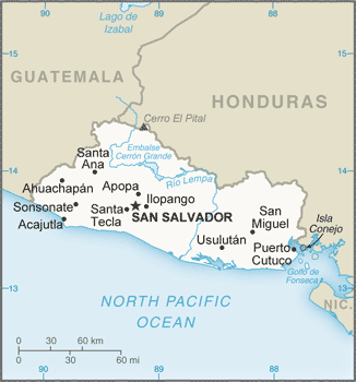
Map of El Salvador
El Salvador achieved independence from Spain in 1821 and from the Central American Federation in 1839. A 12-year civil war, which cost about 75,000 lives, was brought to a close in 1992 when the government and leftist rebels signed a treaty that provided military and political reforms. El Salvador is beset by one of the world’s highest homicide rates and pervasive criminal gangs.
El Salvador’s names conventional long form: the Republic of El Salvador, conventional short form: El Salvador, local long form: Republica de El Salvador, local short form: El Salvador, etymology: name is an abbreviation of the original Spanish conquistador designation for the area “Provincia de Nuestro Senor Jesus Cristo, el Salvador del Mundo” (Province of Our Lord Jesus Christ, the Saviour of the World), which became simply “El Salvador” (The Savior). Name is an abbreviation of the original Spanish conquistador designation for the area “Provincia de Nuestro Senor Jesus Cristo, el Salvador del Mundo” (Province of Our Lord Jesus Christ, the Saviour of the World), which became “El Salvador” (the Savior).
El Salvador’s terrain is typically mostly mountains with a narrow coastal belt and central plateau. The country’s mean elevation: 442 m, elevation extremes; lowest point: Pacific Ocean 0 m, highest point: Cerro El Pital 2,730 m.
The country’s general climate is tropical: rainy season (May to October): the dry season (November to April): tropical on the coast: temperate in uplands.
The total number of border countries is 2, Guatemala 199 km, Honduras 391 km are the neighboring nations with the indicated border lengths. El Salvador’s coastline is 307 km, while its marital claims are: territorial sea: 12 nautical miles, contiguous zone: 24 nautical miles, exclusive economic zone: 200 nautical miles. Waterways: (Rio Lempa is partially navigable by small craft) (2011). Land use: agricultural land: 74.7%; arable land 33.1%; permanent crops 10.9%; permanent pasture 30.7%; forest: 13.6%; other: 11.7% (2011 estimate).
The population in El Salvador 6,187,271 (July 2018 estimate), urban population: 66.7% of total population (2015), major urban area’s population: SAN SALVADOR (capital) 1.098 million (2015), while El Salvador has N/A. Their spoken languages are Spanish (official language), Nawat (among some Amerindians). Main religions in El Salvador are Roman Catholic 57.1%, Protestant 21.2%, Jehovah’s Witnesses 1.9%, Mormon 0.7%, other religions 2.3%, none 16.8% (2003 estimate). The nation uses civil law system with minor common law influence; judicial review of legislative acts in the Supreme Court. It is a(n) presidential republic, National holiday(s) Independence Day, 15 September (1821).
Economic overview for the country: The smallest country in Central America geographically, El Salvador, has the fourth-largest economy in the region. With the global recession, real GDP contracted in 2009, and economic growth has remained low, averaging less than 2% from 2010 to 2014, but recovered somewhat in 2015-2017 with an average annual growth rate of 2.4%. Remittances accounted for approximately 18% of GDP in 2017 and were received by about a third of all households.
In 2006, El Salvador was the first country to ratify the Dominican Republic-Central American Free Trade Agreement, which bolstered the export of processed foods, sugar, and ethanol, and supported investment in the apparel sector increased Asian competition. In September 2015, El Salvador kicked off a five-year $277 million second compact with the Millennium Challenge Corporation – a US Government agency aimed at stimulating economic growth and reducing poverty – to improve El Salvador’s competitiveness and productivity in international markets. The Salvadoran Government maintained fiscal discipline during reconstruction and rebuilding following earthquakes in 2001 and hurricanes in 1998 and 2005. Still, El Salvador’s public debt, estimated at 59.3% of GDP in 2017, has been growing over the last several years.
Natural resources of El Salvador: hydropower, geothermal power, petroleum, arable land.
Main export partners for El Salvador, Central America, and the Caribbean are US 47.1%, Honduras 13.9%, Guatemala 13.6%, Nicaragua 6.6%, Costa Rica 4.5% (2015) for offshore assembly exports, coffee, sugar, textiles and apparel, gold, ethanol, chemicals, electricity, iron, and steel manufactures, while the main import partners for the country are: US 39.4%, Guatemala 9.6%, China 8.1%, Mexico 7.4%, Honduras 5.7% (2015) for raw materials, consumer goods, capital goods, fuels, foodstuffs, petroleum, electricity.
When you visit this country in Central America and the Caribbean, consider the natural hazards in El Salvador: Known as the Land of Volcanoes, frequent and sometimes destructive earthquakes, and volcanic activity, extremely susceptible to hurricanesvolcanism: significant volcanic activity, San Salvador (elevation 1,893 m), which last erupted in 1917, has the potential to cause considerable harm to the country’s capital, which lies just below the volcano’s slopes, San Miguel (elevation 2,130 m), which last erupted in 2002, is one of the most active volcanoes in the country, other historically active volcanoes include Conchaguita, Ilopango, Izalco, and Santa Ana, while infectious diseases are a degree of risk: high food or waterborne diseases: bacterial and protozoal diarrhea vectorborne diseases: dengue fever. Note: active local transmission of Zika virus by Aedes species mosquitoes has been identified in this country (as of August 2016); it poses a substantial risk (a large number of cases possible) among US citizens if bitten by an infective mosquito; other less common ways to get Zika are through sex, via blood transfusion, or during pregnancy, in which the pregnant woman passes Zika virus to her fetus (2016). Also, note that El Salvador faces the following environmental issues: Deforestation, Soil erosion, water pollution, Contamination of soils from the disposal of toxic wastes.
You may also be interested in the countries next to El Salvador around its total: 590 km border, like Guatemala, Honduras.